
First Satellite Tag Deployments for Atlantic BRS 2024
July 8, 2024
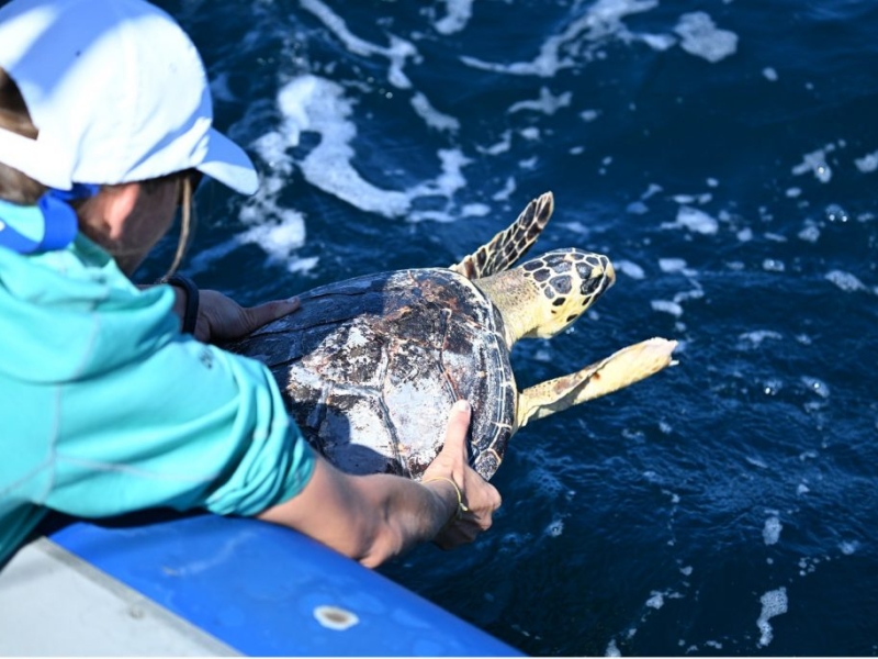
In June 2024, a Duke University team initiated the Atlantic Behavioral Response Study (BRS) by deploying satellite-linked dive recorders on goose-beaked whales (Cuvier's beaked whales) off the coast of North Carolina. These tags collect data on the whales' diving behavior and locations, enhancing understanding of their baseline activities. Additionally, the team released a rehabilitated hawksbill sea turtle named Bagheera back into the Atlantic Ocean.
Whales of Summer
June 10, 2024
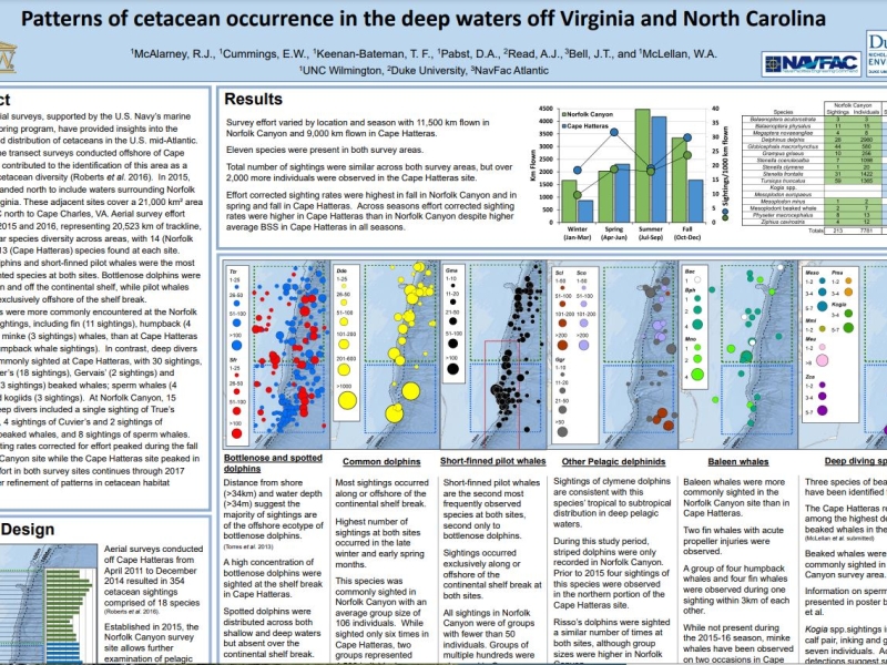
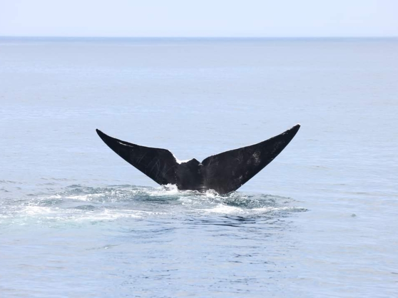
In the mid-Atlantic, baleen whale sightings typically occur during the colder months, with peak activity in December and January. Sightings of humpback and right whales usually decrease by late March through April. While occasional baleen whale sightings, particularly of fin whales, happen during warmer months, large groups are uncommon as summer approaches. Pelagic surveys during this time often focus on odontocetes like sperm whales and beaked whales.
Kauai' Field Work Updates
February 16, 2024
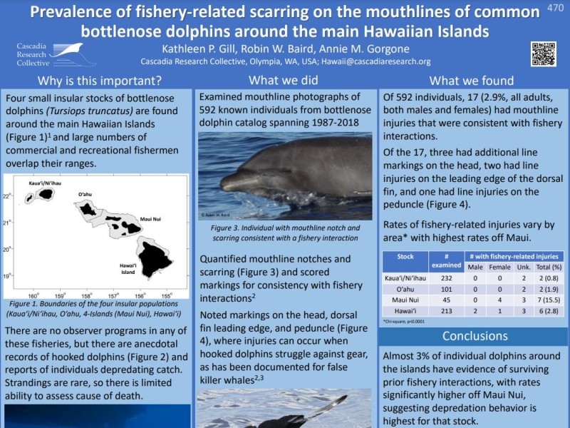
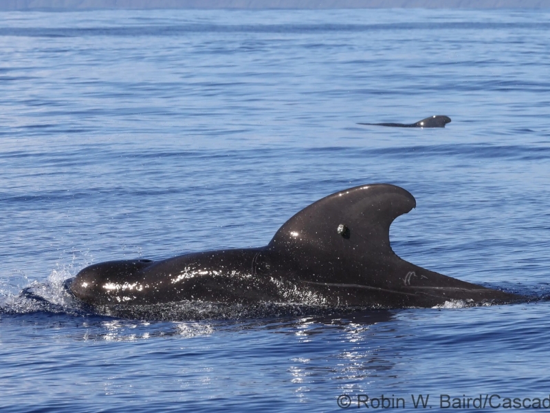
Scientists from Cascadia Research Collective are leading a ~9-day field project off Kaua’i that started on February 11th.
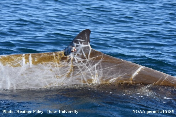
Hatteras tagging wraps up for 2015
November 10, 2015
The finale of a successful field season.
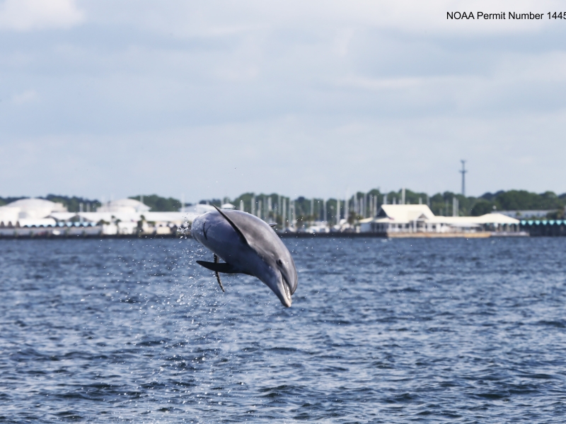
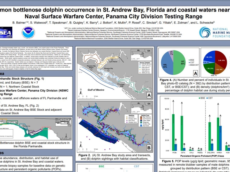
Panama City Dolphin Survey Complete!
August 12, 2015
Bottlenose dolphin photo ID efforts in Florida
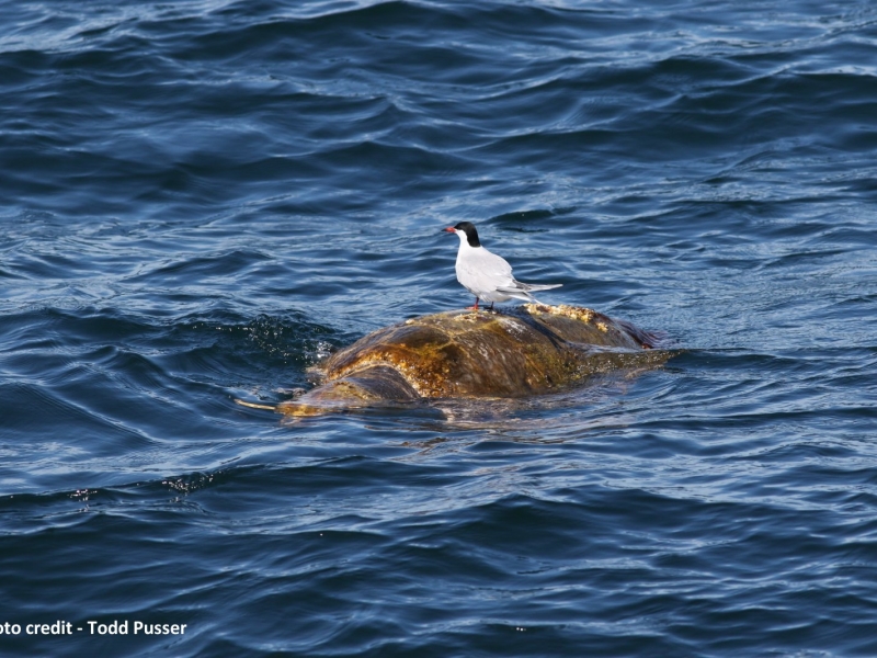
Great Day for a Mid-Atlantic Offshore Survey
April 20, 2015
Pelagic cetaceans and sea turtle sightings.
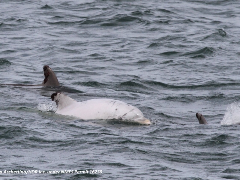
White “Leucistic” Bottlenose Dolphin Seen on Marine Mammal Survey
October 30, 2014
Leucism, like albinism, is a genetic condition that results in a lack of pigmentation in the skin.
Current
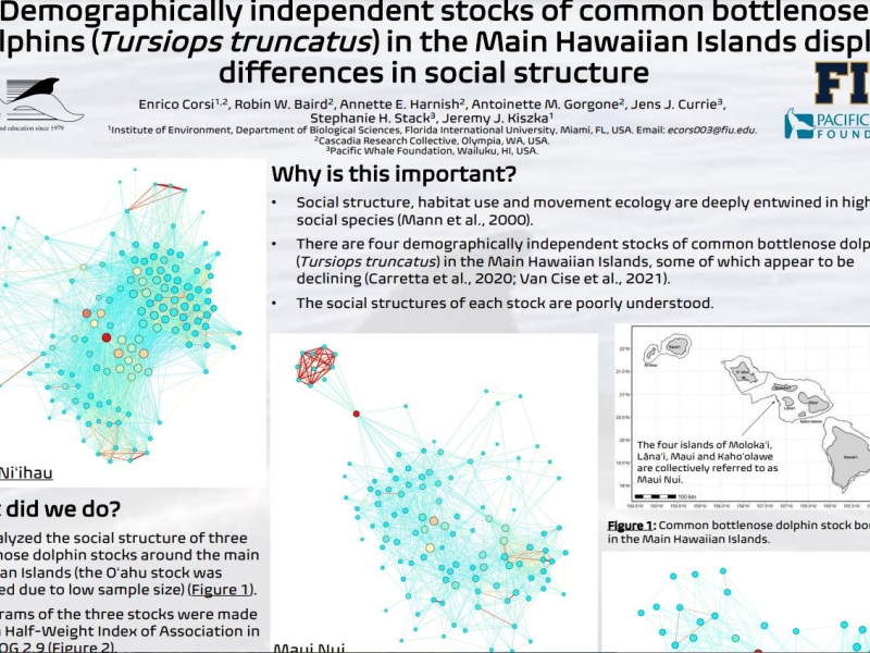
Visual Survey and Tagging of Hawaiian Odontocetes
Project Objectives
(1) define the spatial movement and habitat use patterns of species that are exposed to mid-frequency active (MFA) sonar (2) determine how these patterns influence exposure and potential responses
Complete
Pacific Islands Marine Mammal Stranding Diseases
Project Objectives
Determine cause of death when cetaceans strand to ensure accurate public understanding of stranding cause, with focus on infectious diseases
Complete
Guam Shore Based Visual Surveys
Project Objectives
Shore-based marine mammal surveys
Complete
Small vessel visual surveys in the Mariana Islands Range Complex
Project Objectives
Identify species of beaked whales, odontocetes, and baleen whales that occur in the Mariana Islands; Monitor marine mammal and sea turtle presence, distribution, and diversity in nearshore waters during key seasons (summer and winter); Develop a better understanding of marine mammal distribution, movement patterns, habitat use, population structure, and abundance; Develop reference library of visually-validated acoustic recordings of marine mammals.
Current
Estimation of Received Levels of MFAS and Behavioral Response of Marine Mammals at PMRF
Project Objectives
Further our understanding of the Monitoring Questions: 1) What is the occurrence and estimated received levels of MFAS on 'blackfish', humpback, minke, sperm and Blainville's beaked whales within the PMRF instrumented range? and 2) What, if any, are the short term behavioral responses of 'blackfish,' humpback, minke, sperm and Blainville's beaked whales when exposed to MFAS/explosions at different levels/conditions at PMRF?
Complete
Assessment of Marine Mammal Vocal Response to Sonar
Project Objectives
Develop analytic methods to evaluate the vocal response of odontocetes and mysticetes to sonar from navy training activities
Complete
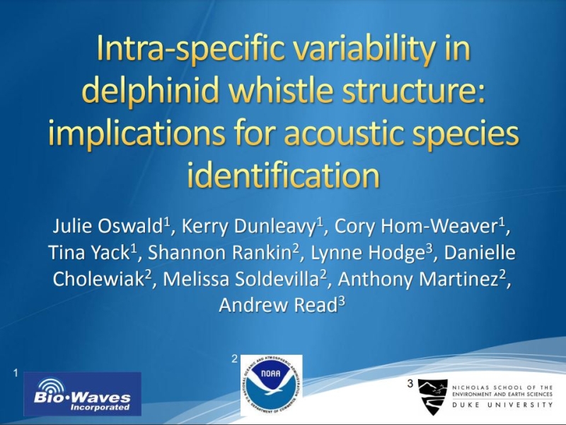
Acoustic Monitoring and Evaluation of Tursiops Response to MINEX Training activities
Project Objectives
Assess ocurrence of Tursiops in the vicinity of the W-50 MINEX range. Assess vocal response of Tursiops to underwater explosions
Complete
NAS Patuxent River Marine Species Surveys
Project Objectives
Assess occurrence, seasonality, and abundance of Tursiops in the waters near NAS PAX River
Complete
Bottlenose Dolphin Occurrence in Estuarine and Coastal Waters near Panama City, Florida
Project Objectives
Determine species occurrence, and distribution, habitat use, and abundance of Tursiops in St. Andrew Bay and coastal waters adjacent to the Naval Surface Warfare Center, Panama City Division.
Complete
Occurrence, Distribution, and Density of Marine Mammals Near Naval Station Norfolk and Virginia Beach
Project Objectives
Assess occurrence, seasonality, and abundance of Tursiops in the coastal waters of Hampton Roads military installations
Complete
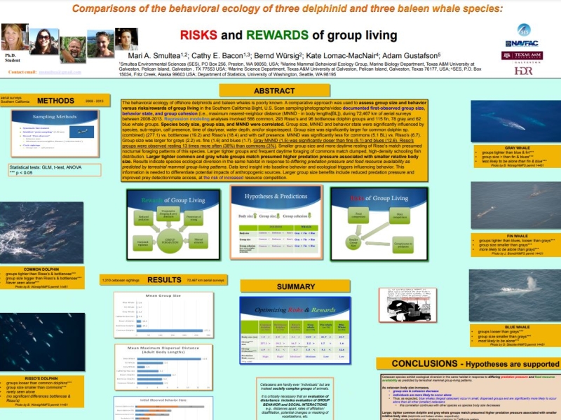
Occurrence, Ecology, and Behavior of Deep-diving Odontocetes
Project Objectives
Establish behavioral baseline and foraging ecology. Assess behavioral response to acoustic stimuli and Navy training activities
Current
Pacific Islands Comprehensive Stranding Investigations
Project Objectives
Conduct comprehensive investigations of stranded marine mammals throughout the Pacific Islands with emphasis on the Hawaiian and Mariana Island chains. This includes conducting necropsies of stranded animals, collecting and archiving samples, conducting disease screening, genetic testing, and analysis of historical data. The objective is to examine stranding patterns and causes of death for marine mammals in the Pacific Islands.
Current
Marine Mammal Sightings During CalCOFI Cruises
Project Objectives
Determine what species and populations of marine mammals are present in Southern California and estimate the abundance and density across seasons
Current
Pacific Marine Assessment Program for Protected Species (PACMAPPS) survey
Project Objectives
Identify species of beaked whales, odontocetes, and baleen whales that occur in the surveyed areas; Monitor marine mammal and sea turtle presence, distribution, and diversity in offshore waters; Develop a better understanding of marine mammal distribution, movement patterns, habitat use, population structure, and abundance; Develop reference library of visually-validated acoustic recordings of marine mammals.
Current
Jacksonville Shallow Water Training Range Vessel Surveys and M3R Species Verifications
Project Objectives
Monitor species composition and distribution on JSWTR, support M3R species verifications
Current
Mid-Atlantic Offshore Cetacean Study
Project Objectives
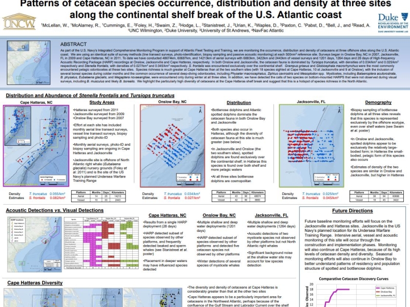
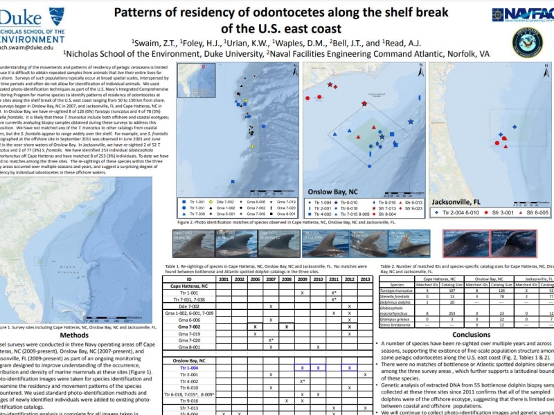
Assess occurrence, habitat use, and baseline behavior of cetaceans in the offshore and continental shelf break region of the VACAPES OPAREA
More details
Collapse details
Date Published:
Filesize:
- April 1, 2018
Five species of sea turtles occur in Chesapeake Bay and the coastal waters of Virginia with varying regularity. They include the loggerhead turtle (Caretta caretta), Kemp’s ridley turtle (Lepidochelys kempii), green turtle (Chelonia mydas), leatherback turtle (Dermochelys coriacea), and hawksbill turtle (Eretmochelys imbricata) (Musick and Limpus 1997). Loggerhead and Kemp’s ridley turtles are the most abundant and regularly occurring species, and green turtle numbers have increased over the past two decades in Virginia (Barco et al. 2015, Swingle et al. 2014, 2015, 2016).
- 1,259.42 KB
More details
Collapse details
Date Published:
Filesize:
- April 1, 2014
The goal of the project is to assess the occurrence, habitat use, and behavior of loggerhead, green, and Kemp's ridley turtles in the Hampton Roads region to better assess the impacts that U.S. Navy activities may have on these protected species.
- 1,337.08 KB
More details
Collapse details
Date Published:
Filesize:
- February 28, 2015
The ultimate goal of this study is to provide the US NAVY with the necessary data to help identify seasonal areas where cheloniid sea turtles are likely to occur in order to inform DOD sea turtle protection efforts. This project focuses on the three cheloniid sea turtle species commonly seen in Virginia, which are the loggerhead sea turtle, Kemp’s ridley sea turtle, and green sea turtle (Hager 2014).
- 6,910.62 KB
More details
Collapse details
Date Published:
Filesize:
- March 1, 2019
Kemp’s Ridley Tagging and Tracking in Chesapeake Bay and Costal Waters of Virginia: Final Report
- 285.40 KB
More details
Collapse details
Date Published:
Filesize:
- June 1, 2017
The goal of this report is to provide the United States (U.S.) Department of the Navy (Navy) with the necessary data to help identify seasonal areas where Kemp’s ridley and green turtles are likely to occur in order to inform Navy environmental planning efforts.
- 1,296.69 KB
More details
Collapse details
Date Published:
Filesize:
- February 1, 2022
In 2013, under an inter-agency agreement (IAA) between the United States Navy and the National Oceanic and Atmospheric Administration (NOAA), NOAA began conducting in-water surveys to record and quantify observations of marine turtles around the Mariana Archipelago. When observed, attempts were made to hand-capture turtles and equipthem with satellite tags in an effort to better understand their spatial ecology.
- 349.81 KB
More details
Collapse details
Date Published:
Filesize:
- February 1, 2021
The United States Navy developed monitoring questions for the Mariana Islands Training and Testing (MITT) study area under the Mariana Islands Range Complex Monitoring Plan (MIRCMP), including questions specifically related to marine turtles as required under the Endangered Species Act (ESA) of 1973. To support the needs of the U.S. Pacific Fleet Environmental Readiness Office, the Marine Turtle Biology and Assessment Program (MTBAP) of the National Oceanic and Atmospheric Administration (NOAA) has been conducting research on marine turtle abundance and spatial-temporal ecology in the nearshore waters of Saipan, Tinian, and Guam since 2013, under a series of Interagency Agreements (IAA).
- 674.99 KB
More details
Collapse details
Date Published:
Filesize:
- January 1, 2024
Understanding the spatio-temporal movements of animals is an integral component of wildlife conservation and management. Sea turtles are species of conservation concern and satellite telemetry is a primary research tool used to study their movements, providing high accuracy location data in near “real time,” thus facilitating rapid identification of movements and key habitats.
- 5,706.75 KB
More details
Collapse details
Date Published:
Filesize:
- January 1, 2020
Understanding the spatio-temporal movements of animals is an integral component of wildlife conservation and management. Marine turtles are species of conservation concern and satellite telemetry is a primary research tool used to study their movements, providing high accuracy location data in near “real time”, thus facilitating rapid identification of movements and key habitats.
- 5,020.67 KB
More details
Collapse details
Date Published:
Filesize:
- September 19, 2024
This report presents a geographic information system (GIS)-based overview of the sighting records obtained during marine species monitoring effort (a total of 12 U.S. Pacific Fleet-funded surveys) to date in the MIRC. Also included are incidental marine mammal and sea turtle sightings made since 1965 on non-dedicated surveys in the region.
- 14,571.64 KB
More details
Collapse details
Date Published:
Filesize:
- February 1, 2013
A long-term goal of this research is the evaluation of the population status of each cetacean stock. This includes producing population abundance estimates using mark-recapture techniques. The first step in the process is the creation of species photo-identification catalogs, which began during the summer of 2012
- 2,353.37 KB
More details
Collapse details
Date Published:
Filesize:
- March 2, 2017
The Pacific Islands Fisheries Science Center’s (PIFSC) Cetacean Research Program (CRP) has been conducting visual surveys and long-term acoustic monitoring for cetaceans in the waters surrounding Guam and the Commonwealth of the Northern Mariana Islands (CNMI) as part of an ongoing effort to develop a record of cetacean occurrence in the region. Visual surveys have been conducted aboard small boats (7.6-12.2 m) since 2010 off the southernmost islands of the Mariana Archipelago (Guam, Rota, Saipan, Tinian, and Aguijan). These surveys include the collection of photographs for individual identification, tissue samples for genetic analysis of population structure, and the deployment of satellite tags for assessment of individual movements throughout the broader region
- 2,999.73 KB
More details
Collapse details
Date Published:
Filesize:
- January 31, 2013
The U.S. Navy developed the Mariana Islands Range Complex (MIRC) Monitoring Plan to provide required monitoring of protected species under the Marine Mammal Protection Act (1972) and the Endangered Species Act (1973). Of the 5 species of sea turtle associated with the MIRC this interim report provides preliminary data on the habitat and movements of green turtles (Chelonia mydas) and hawksbill turtles (Eretmochelys imbricata) in the nearshore waters of Saipan, Tinian, Guam – and the waters in between during migration.
- 1,200.48 KB
More details
Collapse details
Date Published:
Filesize:
- January 15, 2016
This report summarizes field research activities conducted in November 2015 by the PIFSC Marine Turtle Biology and Assessment Program (MTBAP), in collaboration with local partners on Saipan and Guam
- 924.60 KB
More details
Collapse details
Date Published:
Filesize:
- May 1, 2014
There are two questions from the FY13-15 Monitoring Plan that primarily guide this project. First, are there locations of greater cetacean and/or sea turtle concentration around Guam, Saipan and Tinian? Second, what is the occurrence and/or habitat use of sea turtles in areas that the Navy conducts underwater detonations?
- 1,874.51 KB
More details
Collapse details
Date Published:
Filesize:
- September 1, 2015
Sea Turtle Tagging in MIRC (Progress Report) -2014 progress report
- 2,020.53 KB
More details
Collapse details
Date Published:
Filesize:
- December 15, 2016
This report summarizes field research activities conducted between 23 October and 24 November 2016 by the PIFSC Marine Turtle Biology and Assessment Program (MTBAP), in collaboration with local partners on Saipan and Guam
- 2,422.75 KB
More details
Collapse details
Date Published:
Filesize:
- January 31, 2019
The overall objective is to collect field data that will enable the Navy and the NMFS to better understand the distribution and habitat use of sea turtles in Guam and the CNMI.
- 3,376.54 KB
More details
Collapse details
Date Published:
Filesize:
- January 31, 2018
The Marine Turtle Biology and Assessment Program (PIFSC, NOAA Fisheries), together with local partners, conducts marine turtle surveys and in-water captures of green turtles (Chelonia mydas) and hawksbill turtles (Eretmochelys imbricata).
- 3,653.04 KB
More details
Collapse details
Date Published:
- January 10, 2016
More details
Collapse details
Date Published:
Filesize:
- August 1, 2007
The objective of Mariana Islands Sea Turtle and Cetacean Survey (MISTCS) was to conduct the first systematic line-transect visual survey of the waters around Guam and the Northern Mariana Islands and generate density estimates for those species which had adequate data.
- 6,725.14 KB
More details
Collapse details
Date Published:
Filesize:
- August 31, 2011
The goal of this initial phase is to process and compile available data from visual surveys performed by both contractor‐led efforts as well as Navy in‐house ones, such that: 1. A GIS‐based summation of all survey tracks could be visualized 2. A geo‐referenced database of sightings can be queried to visualize sightings by species or survey variables such as observer platform, sea state, or season
- 2,020.33 KB